Day 9 & 10 Somewhere along Bear Creek to Muir Trail Ranch

Day 9 Somewhere along Bear Creek to Somewhere in a marshy area before Senger Creek. 9 miles (keeping it consistent)

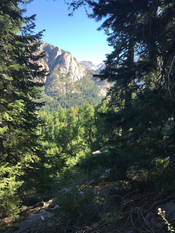
This morning was cold, making it hard to get out of my sleeping bag. For some reason I had it in my head that today was not going to be that hard.  The climb to Seldon Pass on the map looked gradual.  Well, I was wrong.  It was beautiful hiking through some meadows and then climbing but I kept feeling like I was about to summit and then it kept going.

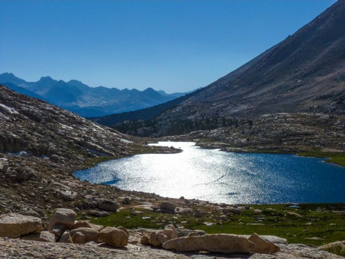
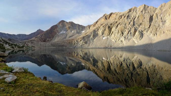
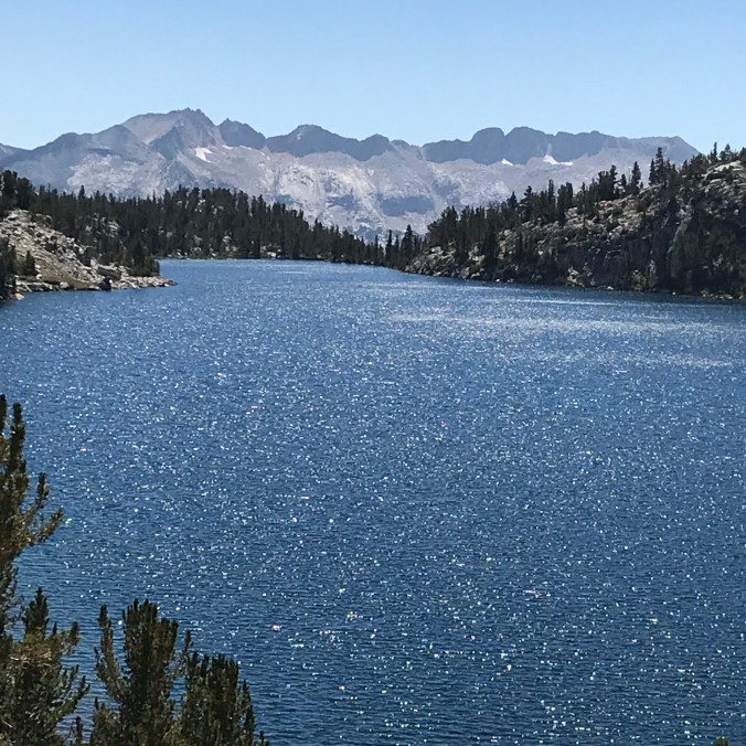
The scenery of course was amazing but I was just feeling a little depleted.  I decided to stop for lunch at Marie Lake.

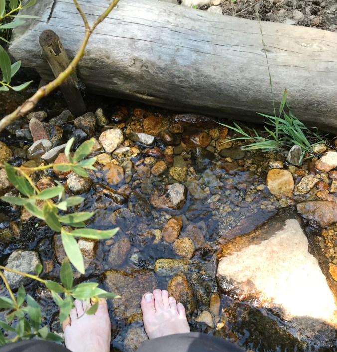
The view was unbelievable.  It was a Sunday and I texted Jeff I was having my own religious experience at this spot.  I took off my shoes, soaked my feet, enjoyed the sun and just took it all in.

It was so peaceful!  Donna eventually joined me.  I started looking around and realized it was a bowl of sorts and the only way out was up.  The climb up over Seldon Pass was so beautiful I didn’t even really realize I was climbing.  I kept stopping to take pictures.

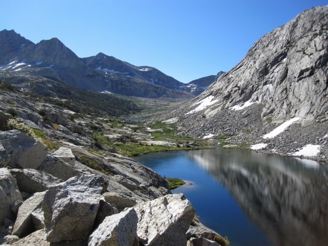
A memorable story here was as I started hiking down and man came running up the trail without a pack.  I asked if all was OK?  He said he had left his phone at Lake Marie and had to go find it.  The thought of going back up and over the pass twice exhausted me.  I felt so bad for him.  The trail continued down to Sallie Keyes Lake.

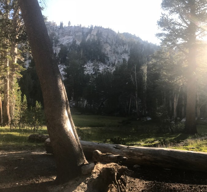
I was planning on spending the night here but it was early and I knew there was suppose to be a 2500 ft descent, which kills my feet.  Donna and I decided to continue on.  The scenery changed drastically and all of a sudden no water was to be found.  We kept hiking.  We finally found a marshy meadow with some small streams of water.  Trying to filter the water from this was tricky and somewhat entertaining.  We set up camp and had a man and his aunt join us.  We tried to figure out exactly where we were and figured it was only 3.5 miles to Muir Trail.  Jeff has rented a cabin for me there.  I was so excited to get there.  The only drag was I found out that I wouldn’t be able to call home.  The word was cell reception was not available.


Day 10 Arriving and staying at Muir Trail Ranch

This morning I hike into Muir Trail Ranch.  It was a steep hike down.  It made me think how happy I was to be climbing down and not up that way.  The hike ended up being more like 4 miles.  Upon arriving I went and picked up my resupply bucket and check in.  This is a very remote place and even though there are cabins and bathrooms you can only get here by hiking or horseback.  As I checked in they gave me an email Paige had sent me.  I started to tear up.  I miss my family so much!!!!

I had to sort through all of my supplies that I had sent to myself.  This is a popular and one of the few resupply places in the area.  Everyone sorts their stuff and leaves it behind for others.  Things that you are tired of eating or don’t want anymore you just exchange or take.  It was fun sitting around with the other hikers swapping stories and food.  I began to realize that there was no way I was going to be able to pack out all of the food needed for the rest of my trip.  It wouldn’t fit in my bear bin and it would have been too heavy.  I texted Jeff and started working on how I could get resupplied.

At the ranch I was able to wash my clothes with an old fashion spinner and then a wringer.  The water was so gross and brown.  I had to spin them several times.  After wringing them out, I hung them on the line to dry.  All the hikers had there stuff hanging out. It was so funny to see all the different items hanging in the open field.  I wish I would have taken pictures. There were also natural hot springs you could soak yourself in.  It was so relaxing and refreshing.  It was like a dream.

Donna was leaving at this point.  Kate and Gina, her friends that left after Reds Meadows, hiked in since the original plan was to all hike to Muir Trail Ranch.   They hiked in and  planned on hiking out the next day to go home.  I went through my pack and found anything unnecessary and unloaded as much weight as possible.  I have really began to appreciate just the slightest amount of extra weight.  They hiked out my extra supplies and mailed them home to me.  I was so grateful to have met them and really appreciated the support and friendship over the last 10 days.  I will miss them.

Along with the cabin, washing station, supplies, and hot springs, you are provided a dinner and lunch the next day.  Tonight they served sirloin steak.  It was amazing.  Also the salad and fruit.  Things that I have missed so much.  Everyone sat together family style sharing stories.  I have met so many remarkable people on this trip!

The downside of this day was not being able to talk to my family. I had planned on being able to and was disappointed when I couldn’t.  I am so happy I have my Garmin and can text but being able to talk with them would have made it that much better of a day.  In my journal I wrote, “It has been an experience to do this alone, but the greater joy would have been to have my family with me”.  It will be hard to leave tomorrow but it puts me that much closer to my family.

Day 7 & 8 Around Squaw Lake to Bear Creek near Bear Lakes Basin

Day 7 Around Squaw Lake to the Somewhere around Lake Edison Jct. Notice how locations become less defined.  9 miles approx.

This morning I forced myself to eat cream of wheat. i think it helped with my energy level. Less than a mile into the morning I arrived at Squaw Lake.  It was stunning.  I had to stop and take it all in.  After looking around I also wasn’t sure where to go. I had walked closer to the lake and lost sight of the trail.  I sat on a rock looking around.  A few minutes later a couple arrived at the lake and we started talking.  Come to find out she was from Mclean, Virginia and knew the daughter of someone I grew up with.  Together we located the trail. I took off and began the climb up Silver Pass.

IMG_2795

Squaw Lake

IMG_2797

Here are a few pictures of the climb out of the basin.

As I continued climbing to the top of Silver Pass I could hear someone hiking up behind me.  I stopped to let him pass but he stopped and wanted to talk.  We continued hiking together only to find out he is from Toolee, Ut where my sister used to live.  Finding people on the trail to talk with is always the best.  Chatting with this guy made the climb so much easier.


The hike down was tough.  I have some descent pictures but only the beginning of the sketchy parts.

This descent reminded me of Clouds rest, lot of steps.  My legs are not that long and on some of the step downs with the weight of my pack I was afraid I might fall.  Thank heavens for my poles.  As I was going down this part I could hear Katie O’Connors voice in my head, “Mrs. Hosking be careful!”.  So funny.  As I was near the end of the decent I found a rock I could rest on by the river.  It was a perfect rock, the kind you can rest the weight of your pack on and not take it off.  While I was resting I ran into my friend Donna again.

It was a long day but I got to the bottom.

Day 8 Somewhere around Lake Edison Jct. to Bear Creek near Bear Lakes Basin Approx. 9 miles

Looking at the map I knew this morning was going to be a climb.  I was anxious about it. I was going to have to climb 2000 ft in about 4 miles.  It was a lot of switchback but it was in a nice forested area and the trail was soft. It ended up not being as bad as expected.  Maybe I was finally getting my trail legs.  Of course once you go up you must once again go down.  Here is the view once I reach the top.

IMG_2821

The climb down was also on a soft trail without too many rocks making it much easier.  The first part was through the forest but then it opened to a beautiful view for the rest of the day.  The scenery was spectacular.

The rest of the day I hike along Bear Creek.  At about 7.5 miles I stopped along the creek and found a wonderful spot to camp but it was only 2:30.  I decided I should keep going. Soon I thought I had made the wrong decision.  I couldn’t find a spot.  By mile 9 I found the best spot right by the river and a waterfall. It was a bit rocky so I had to tie my tent down to rocks.  Donna ended up joining me again. We spent a great evening relaxing, cleaning and enjoying the river.


Day 5 & Day 6 Reds Meadows to Somewhere close to Squaw Lake

Day 5 Reds Meadow to Duck Pass 11.2 miles

The plan at the beginning of the day was to cut the day short and only hike about 5 miles.  I wanted to make sure I kept my feet in good shape for the rest of the hike. The hiking was easier today because the trail was nice and the climb was very gradual.

This is from the first climb out of Reds Meadow.  A fire previously burned here. Along theIMG_2752

trail you see two red mountains which are called the “red cones”.  Lots of people drop their packs and hike to the top but I chose to continue on.  I stopped to soak my feet in a small stream as a early afternoon stop.

IMG_2753

I reached Deer Creek where I had planned to stop for the day at 1:30.  I just felt it was too early to stop.  Donna and I had been hiking together and she decided to stop but I went on.  The problem was I knew if I kept hiking I was going to have to go another 6 miles because water was hard to find.  I did pack extra water at this point only making my pack that much heavy but I am glad I did.  My gps showed lots of stream crossings but everything was dry.  It was a very gradual climb but it was constant.

With 3 miles left I was exhausted.  I hit the wall and didn’t want to go on.  It took me 3 hours to hike the last 3 miles.  It seemed like I was never going to find water and a spot to camp.  I finally arrived at Duck Pass and found a great camping spot by a small waterfall.  It was perfect.  I didn’t arrive until 7pm so I had to set up and eat dinner quickly before it got too dark and too cold. I know it may seem early to everyone else

but I was usually in bed by 7pm.  It actually ended up being nice to be up later and that evening was very peaceful.  What I wrote in my journal this day, “I may have had a mini meltdown on the trail but I made it and I am still enjoying this journey”.

Day 6 Duck Pass to Who really knows? 9?miles

I have lost track of time.  I didn’t want to get up this morning.  I was sooo warm and it was cold outside.  I couldn’t remember what day it was and I was just dragging.  I crossed the river and started climbing to Purple lake. IMG_2758 I actually climbed up just a short distance before descending into purple lake.  For some

reason the morning view and hike felt boring and not exciting.  I stopped at purple lake and met some women from Hawaii that said they had been feeling the same way that morning.  I was also having a had time eating enough calories and nothing tasted good.  Looking at this picture its hard to believe I wrote the words boring and monotonous in

IMG_2765

my journal. Next was Lake Virginia.  I started feeling better and the views helped.

IMG_2773 
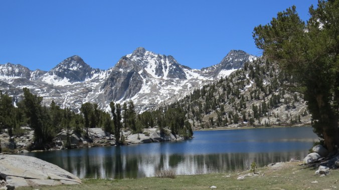
This may be my favorite picture from the trip.  The way the sun was hitting the water.  I stopped at Lake Virginia and soaked in the beauty and rested.  It’s a good thing.  The next few miles were hard because it was all downhill.   I found going down almost harder than the climbing. It was hard but the descent included beautiful mountains all around and a roaring river down the middle.

Getting water from this river was going to be tricky so I kept hiking in hopes of making it to Squaw lake.  As usual the last mile of the day is the hardest.  I had been warned that if you don’t make it to certain lake before 4pm you may not be able to locate a camping spot.  I knew the spots were limited at Squaw lake and so I started looking for somewhere to stop.  I asked a few hiker coming from the other direction if it was crowded and they said I should stop sooner rather than later.  I found a spot that look like it could have been used before but it wasn’t great.  It is always tricky, do you keep going in hopes there is a better spot?  You never know how far away that spot might be.  I took my pack off and struggled with the decision. I said a quick prayer and decided to move on.  Not too far up the trail I crossed a river and found a secluded, perfect spot.  This was a night that I spent completely alone.  I didn’t see another person for the whole evening. My pack is heavy, my hips are raw and my feet are covered in blisters but for some reason I am starting to fall into a rhythm and feeling more comfortable.

IMG_2791

Lyell Fork Bridge to Reds Meadow Days 2-4

Day 2:  Lyell Fork Bridge to Island Pass  8 miles

I woke up on day 2 ready to hike. I knew my first big summit was ahead.  The hike up to Donahue Pass was beautiful. The trail was nice with lots of river crossings.  Crossing the rivers was made so much easier with poles.


Its hard to see in this picture from 1st glance but the trail crosses this river and if you look close you can see the rock path. Here are a few more of the crossing that day.

IMG_2645

Soon I reached a small lake at the base of Mt. Lyell.  I wish I had taken different pictures because the view back down into the valley was amazing.  This was the best one I took.IMG_2655In these next picture the snow on Mt Lyell use to be a glacier but not much is left.

IMG_2653IMG_2657
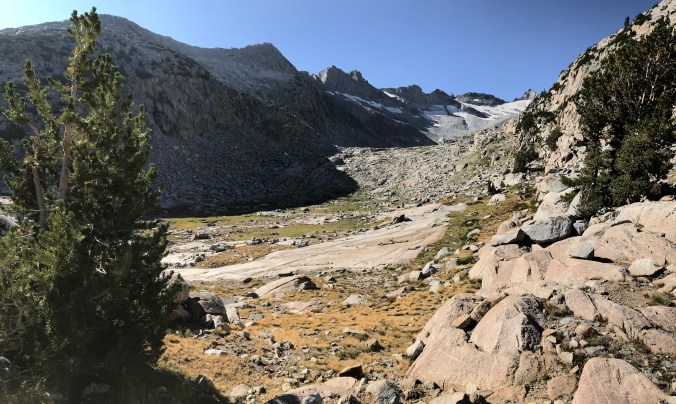
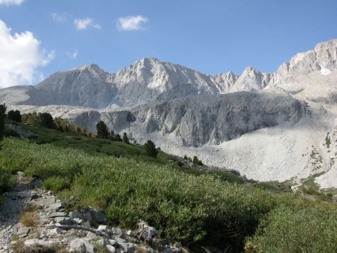
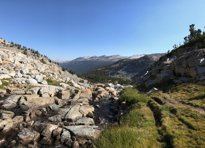
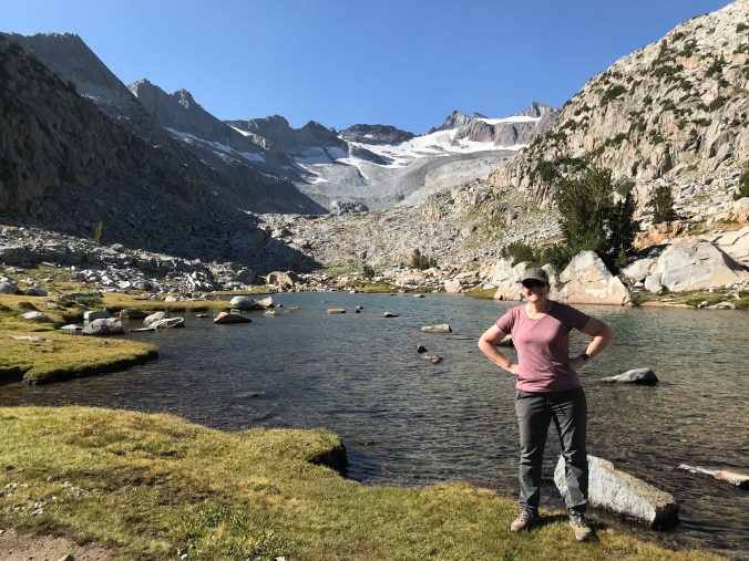
This was such a great spot for a break before reaching to top of Donahue Pass.  This climb was hard because it was through rough rocks and granite.  Luckily I could see people ahead of me and it helped me locate the trail a few times. Here is the top of Donahue Pass.  The elevation is 11,060.IMG_2660
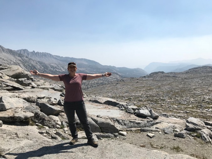
Today was Jacob’s birthday and there was cell reception at the top so I got to call and wish him a Happy Birthday.  I look so happy in this picture.  If I only knew what lied ahead.  The descent.  It was rough for the first few miles.  This is when I began feeling so much pain in my toes.  After a few miles descending I began the climb to a lower pass where I planned on spending the night.

Yesterday the friend I met from Arizona told me that at the top of Island Pass was a beautiful lake and a great place to stop.  I was exhausted and my feet were really hurting.  I hit what I thought was the top only to find a gross muddy pond.  I kept going and finally reached the lake or lakes. They were small but on both sides of the trail.  At first I couldn’t find a camping spot but at the far end of the pass I found the perfect one. IMG_2672

Later that evening some smoke blew in.IMG_2668
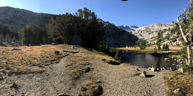
This was such a peaceful spot which I need because I was exhausted.

Day 3: Island Pass to Rosalie Lake 9.8 miles

I woke up thinking maybe I needed to cut my toenails shorter and that would help with the pain.  I wasn’t sure if the downhill had caused my toes to bump into my shoe.  I had been hiking in these boots for months and never had a problem so I couldn’t understand why they were hurting so badly.  As I went to clip my big toenail back, puss began shooting out.  Sorry to gross anyone out but it was so gross and extremely painful.  I quickly put pressure on it and wrap it with a band-aid and tape. I knew better than to do the same with my other big toe so I barely clipped it and let the puss gentle drain out.  Needless to say, day 3 started off badly.  I was apprehensive and not excited to start hiking. After hiking for about a quarter of a mile I came around a corner to see the most stunning lake of my whole trip.  This made the pain of my feet almost disappear.IMG_2675 (2)
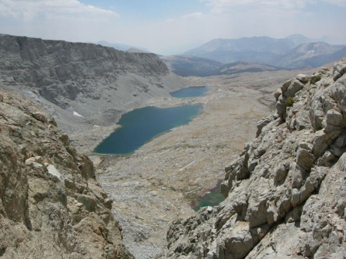
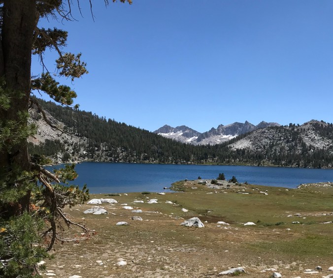
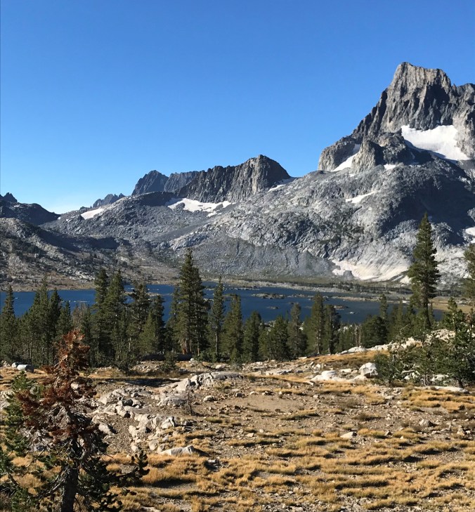
This is Thousand Island Lake.  I took so many pictures but I will share a few.  One day I want to return and spend a day here.

The rest of this day I called the day of lakes.  I passed so many.  I hiked off and on this day with my friends from Arizona.

Here is where I had lunch.  I can’t remember the name of this lake.

Here is a picture of the group from Arizona taking a lunch break.IMG_2694Here is a look of the rocky trails that I was constantly climbing and other views from the trail. The hiker is Bob from the Arizona group.  If I remember correctly he is 65.  I hope I’m still backpacking at 65.

I know the start of the day was bad but this may have been my favorite day on the trail.  It was still hard but the whole day was filled with such views and beauty it seemed easier.  Finally arrived at Rosalie Lake.  The group from Arizona decided to continue hiking but I couldn’t leave once I was at the camping spot.  It was perfect.

A bit of smoke had settled on the lake but I felt it added to the beauty.IMG_2717
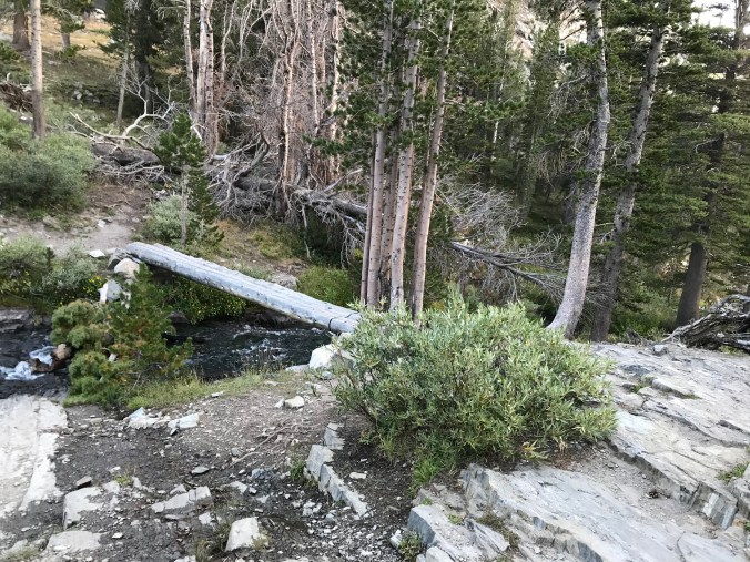
I probably spent and hour just sitting here taking it all in while soaking my feet.

Day 4: Rosalie Lake to Reds Meadow 8.7 miles

I got up and going early this morning.  The thought of making it to my first resupply spot was exciting and Jeff had reserved a room for me so I was also going to get to shower and sleep in a bed.  That was a great motivation.  The morning started with a fairly easy climb and the trail was nice and sloping.  Here is a lake I passed early in the morning.IMG_2720

The trail was nice and easy for the first 5 miles. I descended 2000 ft.

My feet began to hurt but I just wanted to be done so I kept on hiking and didn’t stopped enjoying the scenery or tend to my feet.  I felt like the trail would never end.  I decided to take a short detour off the JMT so I could see the National Monument, The Devils Postpile.

At this point every step was painful.  I continued to follow the signs and my gps and ended up at a road.  I wasn’t exactly sure where I was but I sat on a rock and was able to call Jeff.  It was so great to talk to him.  After I got off the phone with Jeff I realized Reds Meadow was just 200 yds. away.

I finally arrived and was able to shower, wash my clothes, pick up my resupply, eat a BLT at the diner. I relaxed on my bed while I got to talk to all of my kids. It was the best!  I did some surgery on my toes.  Letting the puss drain out released the pressure and pain.  I did some internet searching and found out that I was probably carrying too much weight and that was the cause of the toe problems.  Along with the puss I had developed several blisters.

I wish I would have taken pictures of the little hut I stayed in and the rest of the place but I was too tired.  My friends from Arizona decided to call it quits.  Everyone that is except for Donna.  She was going to continue on alone.  The next five days we hiked together off and on.  Her support and encouragement was such a blessing for me.

John Muir Trail Day 1

I want to thank everyone for the love, support and prayers.  I could feel it.  I was amazed when I came home to find out how many people were routing me on. All I can say is Thank You!  I am a very blessed.

I plan on posting all of my pictures and stories best I can but will do it gradually.  Jeff did a great job keeping everyone up to date and I even enjoyed reading the post when I got home.  I hope my posts are just as entertaining but probably not.

Day 1:  Tuolumne Meadows to Lyell Canyon  11 miles

The best place to start is from the very beginning.  This picture does not tell the real story.  Yes, I am at the beginning of the adventure but what you can’t see is what is going on inside.  For some reason, when I pulled into the parking lot of the trail IMG_2323

head, I started getting extremely nervous and began to have doubts.  I felt sick to my stomach and began thinking “what the heck am I doing?”.   As I put on my pack it felt so heavy and it really sunk in how hard this was going to be.  Jeff hiked with me for the first mile and then we hugged and said goodbye.  As I turned around to leave the tears came.  I probably cried for the first 5 minutes and then the beauty of my surrounding took over and I could feel myself get into a rhythm and the doubts and fears faded and I was so excited.

The first 8 miles is an easy flat hike.  Perfect for acclimating to the altitude. I stopped for lunch and met a woman who was hiking with a group from Arizona.  Her name was Donna. She had hike the JMT two years earlier and was back to hike most but not all of the trail this time. As it turned out, Donna and I would hike on and off together for the first ten days.  She was such a great support and friend on the trail.  There came I point where I realized this nice easy trail was not going to last and eventually I would be climbing up and over those mountains ahead.  As I started climbing I knew two things. IMG_2641

My pack was heavy and my lungs were not use to this altitude.  The last 2.5 miles on the first day may have been my hardest.  It was a tough climb and I was tired, but I made it to Lyell Fork Bridge.  Donna and her friends were camping a few miles past this spot and invited me to join them but I was exhausted and ready to stop, so I did.  I found a spot right over the bridge and close to the river.  This is a picture of what I saw from my spot.IMG_2642
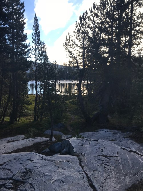
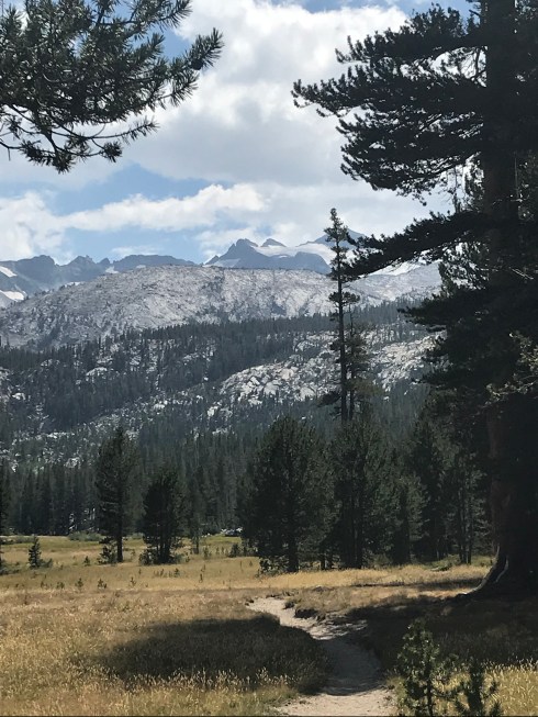
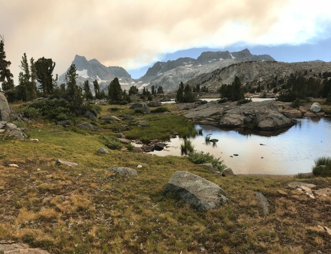
This spot was so peaceful and quiet.  I think I only saw one other person camping in the area.  A ranger actually showed up that evening and checked my permit.  The only time on the entire trip anyone check. After finishing the first day I realized I could do this.  I just needed to go at my own pace and hike my own hike.

The Penultimate

Pam has been powering through the miles this past week.  She accelerated her pace last week in order to meet up with her resupply team, then never let off the gas.  That really comes as no surprise to anyone who knows her.

As a result, on the strength of a 12 mile day today, tonight is Pam’s last night under the stars.  She is camped at Guitar Lake, which is situated just before the first steep climb to the Mount Whitney summit.

Guitar-Lake-1.jpg

Rising 14,505 feet above sea level, Mount Whitney is the highest point in the contiguous United States.  The summit is a little more than 5 miles in distance and 4,000 feet in elevation from Guitar Lake.  For those in the East Bay, it is roughly the equivalent of hiking to the top of Mt. Diablo in terms of elevation gain.  Once she summits, it will be another 10.6 miles to Whitney Portal, with more than 6,000 feet of descending.  I will be waiting for her at trail’s end.

Statistics:  In less than three weeks, Pam hiked 220 miles from Tuolumne Meadows to Whitney Portal, climbing a cumulative 60,597 feet.  We are all very proud of her and cannot wait to hear her stories.


Southbound and Down

Pam hiked just short of 8 miles today, with a maximum elevation of a little over 13,000 feet as she climbed over Forester Pass on her way to Tyndall Creek.  Below is her view of the climb as seen from Vidette Meadow where her morning began.  The pass is well above the tree line.  I was a little concerned when Pam reported she was getting hail this morning since there is not much in the way of shelter over the pass.

climbtoforester.jpg

Many switchbacks later, Pam summited the pass and was rewarded with this view, looking south toward her destination for the evening.  It is a barren area.  Take away the lakes and it would almost resemble a moonscape.

view from the pass.jpg

It will not be long before Mt. Whitney, her final challenge, comes looming into view.

Pam has been blessed with mostly excellent weather most of her hike, but the past two days Mother Nature has come to collect her due.  Hail today and rain yesterday tested Pam’s inclement weather preparation.  Fortunately, she came through it like a pro and reports she is snug and dry in her tent.  This afternoon, she said, “the clouds parted and it was sunny just enough for me to set set up my tent.”  Trail blessings.

Pam has many more miles to cover before she is done, but she is getting close enough that we are starting to think about some of the details of our meeting at the end of the hike.  Cannot wait to be together again.

Rendezvous

I noted in earlier posts that yesterday was the day Pam was scheduled to meet up with Paige, Jacob & friends for a resupply.  Muir Trail Ranch was her last resupply stop and it was not possible for Pam to fit 14 days of food into her bear canister.  As a result, we had to make plan for someone to meet her on the trail this weekend to bring her enough food to get her home.

As fortune would have it, Paige was scheduled to go on her own adventure this weekend–kayak camping along a river on the Northern California coast with her friends Katie, Josh and Alicia.  There was a hiccup in their plans and everyone kindly agreed to rearrange their adventure to help Pam.  We are very grateful for good friends.

It was a logistical challenge to get the group to a trail that would intersect with the JMT at the right place and at the right time.  Fortunately, Paige came up with a brilliant plan that could not have worked out much better.

IMG_0166.jpeg

The group set out early Saturday morning with the intention of driving to Kings Canyon Nat’l Park, then hiking in about 9 miles.  Sunday they hiked the remaining 7 or so miles to the Woods Creek Crossing of the John Muir Trail.  That trail intersection was already on Pams’ schedule for a camping spot on Sunday night.  Here’s a picture of Paige hiking thru the aptly named Paradise Valley where the group camped their first night.

The Woods Creek Crossing of the JMT is notable for the suspended footbridge that spans Woods Creek.  It is a marvel of engineering, particularly considering its remote location, and is a bit of a wobbly experience.  The resupply team reached Woods Creek before Pam did and managed to capture this picture of Pam crossing the bridge, with Paige and Jacob ready to greet her on the other side.

IMG_1296.jpeg

They had a wonderful reunion and a great time together, camping at Woods Creek Sunday night.  Pam reported she “had such a great day with the kids.  It really bolstered my spirits.”

The next morning, resupplied and reinvigorated, Pam said goodbye to the group and headed down the trail.  While she would have loved to have spent more time with them, it was back to the business at hand of completing her journey on the JMT.

IMG_1297.jpeg

Pam had another full day today, hiking roughly 7 miles to the stunning Rae Lake, where she is making her camp.  According to Jacob, she is doing amazing.  He and Paige also commented that Pam has made a number of friends along the trail and she is camping with them tonight.

rae-lakes-7.jpg

As for the resupply expedition, they hiked out 16 miles today, for a total of 32, and are driving home all the way from Kings Canyon tonight.  They are about 40 minutes away from home as of this typing.  They will drop some items here, then Paige & Alicia will continue on to San Francisco.

It feels like Pam is in the home stretch, although she has plenty of challenges ahead, including a 14 mile day that includes summiting Mt. Whitney, the highest peak in North America.  She faces these last tests with a full canister of food and a full heart for all those who have supported her and made this adventure possible.

Special shout out to Alicia, Katie, Josh, Jacob & Paige.  You guys are awesome.


Downs, Ups and Friends in Need

The rhythm of the trail includes peaks and valleys–literally and figuratively.  Pam had both today, climbing over Mather Pass–4,100 merciless feet of climbing–on her way south to rendezvous with Paige, Jacob, Katie, Josh and Alicia further down the trail.

DSC01009.jpg

After an 11 mile day, Pam was rewarded, literally, with this stunning view from her campsite tonight at Lake Marjorie; and figuratively, by the kind folks who saved a camping spot for her with their group for the night.

Tonight, Pam’s spirits are high.  They will be boosted further when she camps tomorrow night with Paige and Jacob and the rest of the crew.

Miles to go before I sleep

Circumstances conspired these past few days to push Pam very hard.  Wednesday, all the camping spots were taken at her planned stopping point, so she ended up hiking a total of 15 miles on tender feet.  The next day was more of the same–11 miles, for a total of 26 in two days. Adding to the challenge of these past few days is the fact Pam’s trail buddy bailed out at Muir Trail Ranch.  While she hikes with someone or often camps within the vicinity of other JMT hikers, Pam spent last night in total isolation–except for the fresh bear tracks around her tent.

All this was compounded by some uncertainty about the resupply mission.  Paige, Jacob & Company planned to intersect the JMT at Bubbs Creek on Sunday afternoon to bring her the food and supplies she needs to complete her trip.  The problem is that Pam was not scheduled to be at Bubbs Creek until Tuesday–there was no way she could make up the time to meet them there two days early.  This conundrum had us all tossing and turning last night.  Pam has been losing weight over the past few days, so the resupply is critical.

Paige and I spent the better part of the morning pouring over trail maps, finally coming up with a plan to meet Pam about 11 miles (essentially one day’s travel) north of Bubbs Creek at Woods Creek Crossing.  With this adjustment, Pam had three days to cover 24 miles–something that is entirely within her demonstrated capacity.  There were a number of moving parts, but the revised plan came together well, for which we are grateful.

palisade lake.jpg

Today was a much better day.  Pam made sure to eat plenty of food and she fell in with a nice group of folks this afternoon.  She was cheered by the company and conversation and they are sharing a campground at the beautiful lake above.

The resupply team leaves early tomorrow.  They will be covering roughly 30 miles over three days, two nights, and will spend Sunday night with Pam.

Our intrepid hiker is entering the last week of her journey.  Soon her thoughts will turn from the day to day necessities and begin reflection on this singular experience.  Thanks to everyone who has inquired about, who are thinking about and have been praying for Pam.